
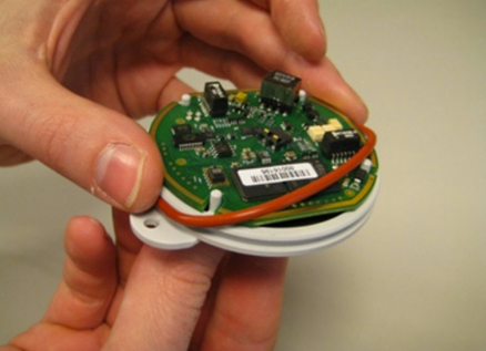
Geophysicists and seismic acquisition crews worldwide are no strangers to the complexities and setbacks that often accompany the usage of traditional cabled geophones when acquiring seismic data onshore. From heightened HSE risk and the labour-intensive setup process to frequent technical failures, restricted mobility and high costs, the challenges can seem endless.
In this blog post, team members at STRYDE share the trials and tribulations of working with cabled geophone arrays in desert environments, highlighting their limitations through a series of real-life experiences from recent projects, as well as how our revolutionary cable-free seismic technology is reshaping the landscape and possibilities of seismic data acquisition…
1. Challenging terrain posing risks and delays
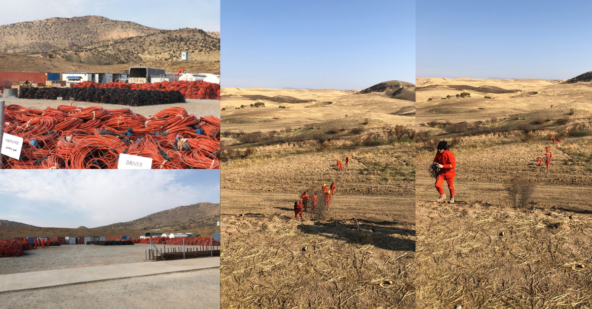
Chris Einchcomb, our Geophysical Advisor, highlights the difficulties of utilising cabled systems in mountainous terrain in a large-scale ~650 sq km 3D seismic survey over mixed land use in Iraq…
“The requirement for this project was a fairly dense network, comprising 12 geophone strings. This led to an increased volume and weight of the receiver equipment - a necessity to ensure an efficient operation with a large active spread. However, dealing with such a large volume of cables in challenging, mountainous terrain brought about its own set of complications.
“The contractor faced the arduous task of employing and training many local staff members to manage the deployment and retrieval of the equipment. Given the difficult landscape, crews often found themselves manually carrying heavy equipment up steep inclines. This posed not only significant health and safety risks but also impacted survey efficiency.
“Adding to the challenges, the considerable volume of hefty equipment necessitated the use of heavy vehicles for transportation across agricultural lands which, predictably, stirred issues with local farmers. Theft of equipment and the constant need for line checking contributed to a substantial amount of non-productive time (NPT), leading to further inefficiencies and financial losses.
“These obstacles were so overwhelming that the survey couldn't be completed within a single operational season. Consequently, the project had to be extended over two seasons, incurring additional costs for both the client and the contractor."
2. Scalability issues and harsh weather resulting in downtime
Kevin O’Connell, STRYDE’s Head of Field Operations, reflects on the effects of an untested system and poor weather conditions on a seismic survey conducted in the Middle East involving 250k cabled channels…
“When using a small cable system with <20,000 channels, it would be expected that technical downtime would average around 1 hour every 24 hours. These downtime figures are often built into the tender pricing. However, as you scale up the channel count on cable crews to 250,000 channels, the technical downtime can increase exponentially due to many factors. For example, an electrical storm rolling over the survey area with lightning strikes on the seismic system would often damage 10,000-50,000 channels at once, leading to days of recovery time and a monetary loss that often reached into six-figures with each storm.
“In one particular mega channel crew in the Middle East, it became evident that soon after the system was deployed, the system had not been designed to handle the channel count as it was intended to. It was clear the system had not undergone any proper scaling tests in real world conditions to identify and fix technical problems before mass production.
“In this case, the system was too power-hungry, leakage-prone, and susceptible to lightning. With damage due to third parties driving over the equipment, leakage into the electronic modules due to rain and electronics damage due to lightning strikes, the crew struggled to maintain the optimum 120,000 channel live shot template. As a result of the huge power consumption per channel, the crew also resorted to using generators to power the system (instead of the standard 12v batteries and solar panels) which made a lot of generator noise on the seismic data.
“The first rain and electrical storm alone resulted in the loss of 90,000 channels, while further lightning strikes crippled large sections of the system. Operating on a reduced spread for most of the contract, the crew barely averaged one third of their target daily production rates. The operation was estimated to have lost many millions of dollars over the duration of the contract - a clear testament to the limitations of cabled seismic systems."
3. Existing infrastructure presenting unnecessary risks and complexities
Following a project that involved 32 receiver lines on a very large 3D survey using cabled geophones with a 16-line roll and a dual carriageway at one end of the swath, Brian Coil, STRYDE’s Technical Support Engineer explains the challenges encountered…
“For this project, overhead cable crossings were not an option and unfortunately, conveniently located culverts that would have allowed us to pass the cables under the road were non-existent. Therefore, we had no choice but to lay the cable crossings across the road.
“To do so required special permission from the local police department, given that we were placing an item on a public thoroughfare. Additionally, to hold the cables securely and prevent damage, we had to use special rubber mats that spanned about 15 metres. Although this provided a reasonable workaround, the sheer volume of road crossings required for this project was staggering. Each swath required 64 road crossings just for the dual carriageway, with an additional 32 new road crossings for each new swath.
“Despite our best efforts to minimise damage, incidents did occur which led to a number of cable repairs. These interruptions not only caused technical downtime but also increased the exposure to health, safety, and environment (HSE) risks.
“To manage these crossing complexities, we deployed a specialised team, but even with this dedicated crew, the HSE exposure remained high. Each swath change required us to inform the local police of our intentions, adding yet another layer of complexity to the task and to ensure public safety, we had to create and display extra HSE signage indicating the road dangers associated with the cable crossings and the ongoing work. As the project advanced, these signs also had to be relocated which created further inefficiencies."
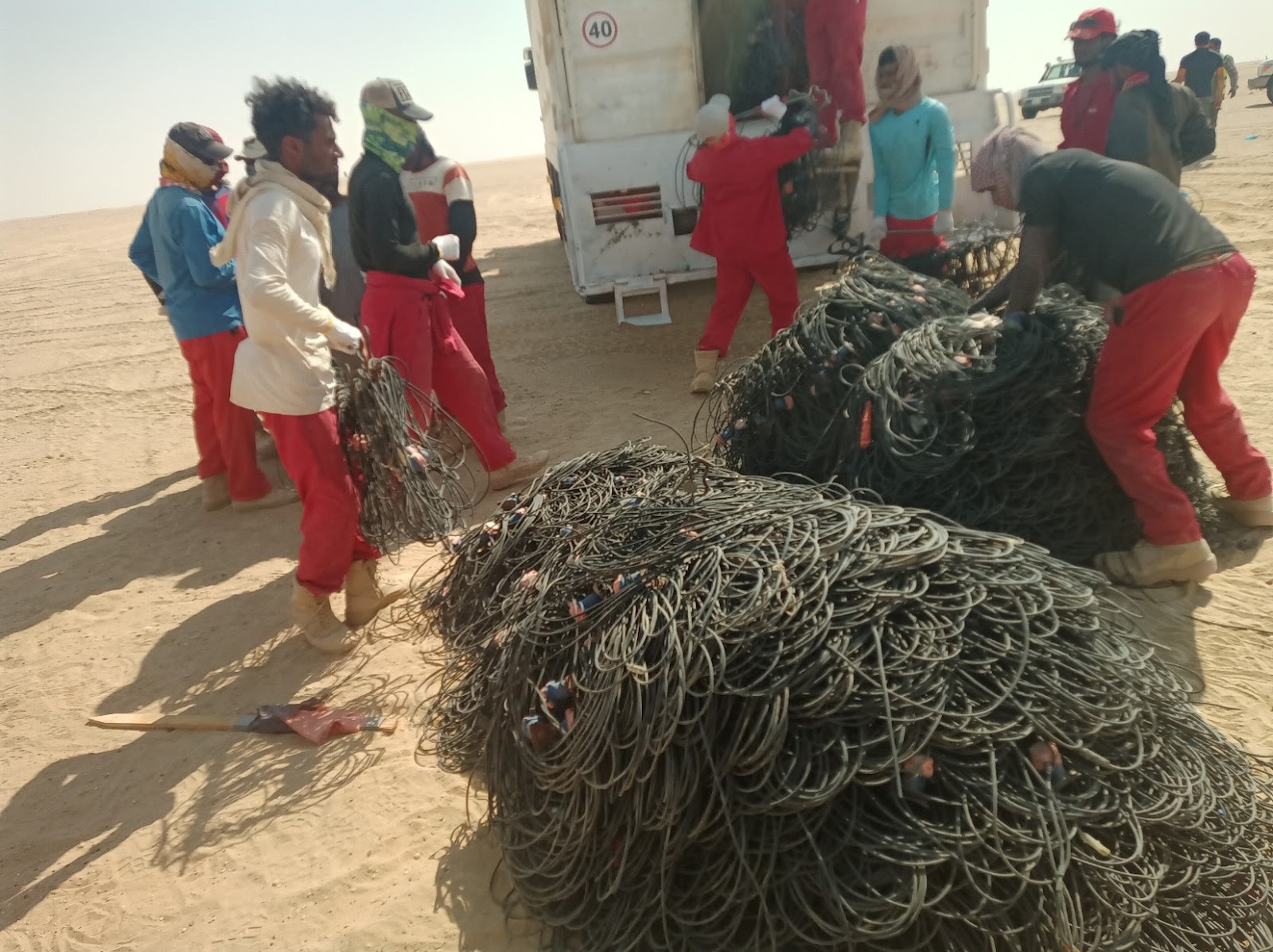
4. High equipment failure rates
Salomon Codiban, Operations Support Specialist at STRYDE and previous field technician for cabled systems discusses the top issues he faced during his time working on cabled seismic crews in the Sabkha desert which is a notoriously wet and salty environment …
CRC errors: A cyclic redundancy check (CRC) is an error-detecting code commonly used in digital networks and storage devices to detect accidental changes to digital data. CRC errors happened frequently on the lines and caused instability and required laborious checks of the connector inserts, the sensor boards or cable integrity on the mid-section. This resulted in a large amount of technical downtime and project delays.
Humidity: Humidity was the root cause of a significant amount of failure of sensors and it was common for one or more sensors on the same string to report higher humidity than others. The problem was often attributed to water travelling along the copper and leaking into the Sensor Network connector (inserts) or water inside the SU boards caused by O-ring failure. When this happened, troubleshooting and maintenance had to occur to get the system back up and running, which resulted in a high amount of non-productive time.
5. Crews pushed to their limits, resulting in disaster
Yassine Elhallaoui, System Test Engineer at STRYDE has extensive experience working with cable arrays and shares one of the most serious incidents he witnessed on a cabled seismic survey in a desert environment…
"I worked on an ambitious seismic survey project amidst this vast and unforgiving desert terrain. This undertaking involved the deployment of 60,000 cabled geophone channels and the use of 40 heavy vibroseis trucks.
"Implementing a cable-based system in such an expansive operation presented an extraordinary challenge to the seismic crew where they found themselves pushed to their limits. Covering distances ranging from 20 to 30 kilometres daily, unraveling rolls upon rolls of diverse cables, and meticulously interconnecting them. At certain junctions, hefty 25-kilogram batteries needed to be installed. The physical strain on the crew was monumental. The relentless desert heat, combined with their arduous efforts, placed the team in grave danger of heatstroke, dehydration, and fatigue – a potentially fatal combination.
"Regrettably, the correlation between increased channels, sheer weight and volume, and physical strain resulted in tragic consequences, leading to the loss of precious lives during this survey.
"This tragedy prompted a crucial question: Could there have been a more viable alternative?"
The future of onshore seismic acquisition is here…
In this demanding profession, the stakes are high, and the conditions are often harsh and these adversities fuel the desire to continually innovate, to seek out solutions that mitigate risks, improve efficiency, reduce costs and above all, ensure the safety and well-being of the crew..
Regardless of the location, environment, terrain or experience of the seismic crew, cabled geophone arrays are proven to incur additional costs, risk, time and environmental footprint when compared to cable-free nodal technology.
At STRYDE, we have an increasing list of clients whose nodal surveys are unlocking a number of benefits and efficiencies. Not only are they reducing risk and environmental footprint in the field, they are also increasing survey efficiencies through a significant reduction in non-productive time due to equipment replacement and line checking, as well as reducing costs via smaller, more efficient crews working in both complex terrains and challenging infrastructure. These efficiencies are all achieved whilst delivering superior, high density subsurface imaging.